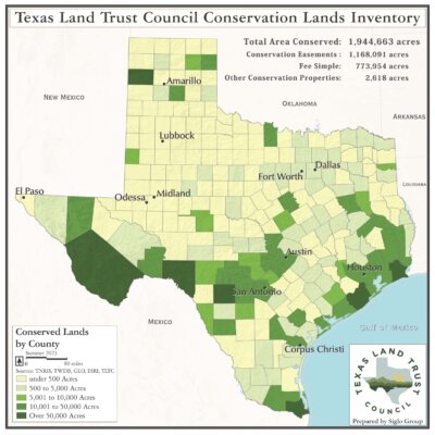
The Texas Land Trust Council (TLTC), through its Conservation Lands Inventory (CLI), is using the power of geographic information to better understand and communicate the success and economic benefits of conservation efforts throughout Texas. The Inventory provides data and visual information on all of the lands protected and conservation easements held by land trust organizations across the state.
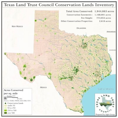
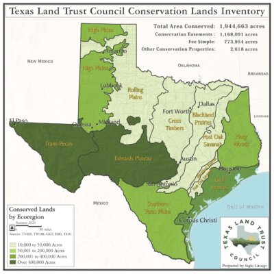
The geographic information systems (GIS) database and associated maps reveal how the efforts of land trusts are collectively influencing the Texas landscape. TLTC collects and updates the data, and the associated maps and charts, every two years. Our latest update reveals that land trusts have helped conserve over 1.9 Million acres across Texas, over 1 Million of those with conservation easements. The CLI remains a unique resource for information on private land conservation found nowhere else in Texas.
In 2019, TLTC released a report that evaluated some of the important, economic benefits provided by the lands that have been permanently conserved by Texas land trusts. Economic values for those benefits were calculated using an ecosystem services approach. Lands were evaluated for their impact on water quality and quantity, inland and coastal flood prevention, and rural economies (agricultural production and wildlife benefits).
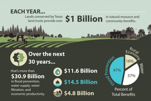
The analysis found more than $1 Billion in annual benefits to Texas taxpayers from the lands protected and conservation easements held by Texas land trusts. This monetary valuation of the benefits that conserved lands provide allows us to more clearly articulate the worth and cost-effectiveness of land conservation to decision makers. The findings represent a great step forward toward recognizing the substantial value that these lands bring to the Texas economy.
The Conservation Lands Inventory seeks to geographically and visually reflect the substantial and combined impact of the ranches, wildlife habitats, farms, forests, and watersheds protected by Texas land trusts. This data and associated analyses continue to be instrumental in improving conservation planning, and in developing tools and information to educate the public about the many benefits of land and water conservation.

